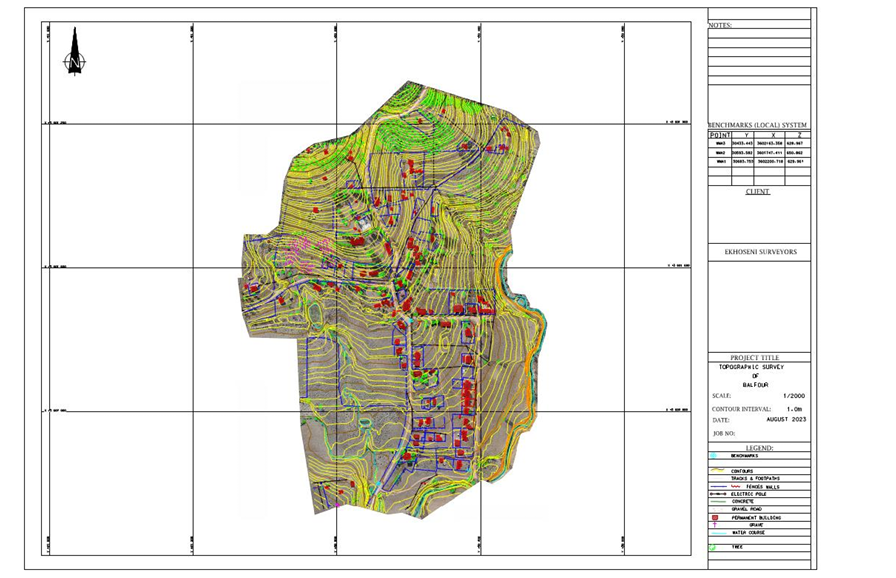
Overview
Topographical surveys provide detailed and accurate representations of the natural and man-made features of a specific land area. These surveys are essential for construction, engineering, and land development projects.
Our Services
Detailed Land Mapping
We capture precise land contours, elevations, and features such as trees, buildings, roads, and utilities.
Boundary Identification
Identify and mark property boundaries to assist in legal and construction processes.
Site Analysis
Analyze terrain to assess drainage patterns, slopes, and potential site challenges.
Data Collection & Reporting
Utilizing advanced surveying equipment, we gather data and deliver comprehensive reports including maps, 3D models, and GIS data.
Why Choose Us?
- Experienced surveyors with local knowledge
- State-of-the-art technology for accuracy
- Fast turnaround times
- Customized survey solutions tailored to your project needs
Applications
- Construction planning and design
- Land development and subdivision
- Infrastructure projects
- Environmental and landscaping studies
Contact us today to learn how our topographical surveys can support your project from start to finish.